-40%
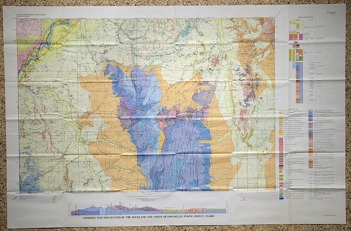
USGS IDAHO GEOLOGY of the ROCKLAND & ARBON Quadrangles POWER COUNTY Nice MAP!
$ 7.39
- Description
- Size Guide
Description
SCARCE ITEM!!This is USGS Bulletin 1399, “
Geology of the Rockland and Arbon Quadrangles, Power County, Idaho
.” Published in 1976, this is a pretty scarce item. This
115-page book
comes complete with the large colorful geologic map.
It is a 15 minute map consisting of two quadrangles, covering an area of about 110 square miles.
The geology is diverse, with formations from Cambrian through Permian age, exhibiting one of the most complete intact sequences of these rocks in the region. There are also later
tertiary
volcanic rocks. The area
straddles
the Basin and Range province and the Snake River plain province, leading to a great breadth of geology exposed in the area and
portrayed
on the map.
The geologic structure is complex with folding and faulting, and the cross section on the map help make it all clear, even though much of the older geology is visible only in a few small windows through the younger rocks.
I have to say reading this was a treat. The geology is so diverse and the treatment in the text so good.
The large color map in this report really makes the geology stand out.
It is one of those reports that gives you a huge perspective on the vastness of geologic time.
Shipping weight is 11 ounces. Media Mail is provided to save you some coin.
I will continue to add new items to my store, so check back periodically.
Expert Packing Assured.
®
ROCKWILER
